Live UK airspace data

Know before you fly.

One map for UK drone pilots: restricted zones, live NOTAMs, council byelaws and weather, plus a one-tap Fly Now check for wherever you are standing.

  • Free to start
  • Works on phone and desktop
  • Updated from official sources
Active NOTAMDanger area, until 31 Oct
Fly NowChecked around you
Features

Everything you check before a flight, in one place

Built for UK pilots. No more hopping between airspace maps, NOTAM lists, council websites and weather apps.

Live map

Tap a NOTAM and read every detail

Restriction zones, danger areas, MATZ, airfields and active NOTAMs on one fast map. Tap any of them for the full text in a plain card, with its hours, heights and status.

  • Zones switch on and off with their published hours
  • Open a card and the map shows only that item, so you can see exactly where it is
  • Council byelaw notes for parks and open spaces
Council byelaws

Know what the council says about drones

Turn on the council layer, tap any area, and read what that council says about drones on its land, with the full wording underneath. In Fife, for example, there is no drone-specific byelaw, but council land is "usually not permitted" by default, and parks and open spaces are allowed conditionally under the council's park rules.

  • Each council area is colour-coded by what its note says
  • The note for where you are standing is also in your Fly Now brief
  • Notes still being checked are clearly marked provisional. They are a guide, so always check the council's own rules
Fly Now

A pre-flight check in one tap

Stand at your launch point and run a scan. Fly Now checks the airspace, NOTAMs, byelaws, parks, schools, protected sites and the weather around you, scores each check, and writes it all up as a brief.

  • Every check is marked pass or caution, with the detail underneath
  • A full written brief you can read before you launch
  • A small map shows what was found and where
Weather

Wind at flying height

An hourly forecast for your location or any address. Slide the height from the ground up to 400 ft and see how the wind changes where your drone will be, checked against your own drone's limits.

  • Wind speed, gusts and direction at the height you choose
  • Go, caution or no-go for each hour, using your drone's wind limits
  • Space weather (Kp) advice for GPS reliability
Flight plans

See other pilots' plans, and message them Pro

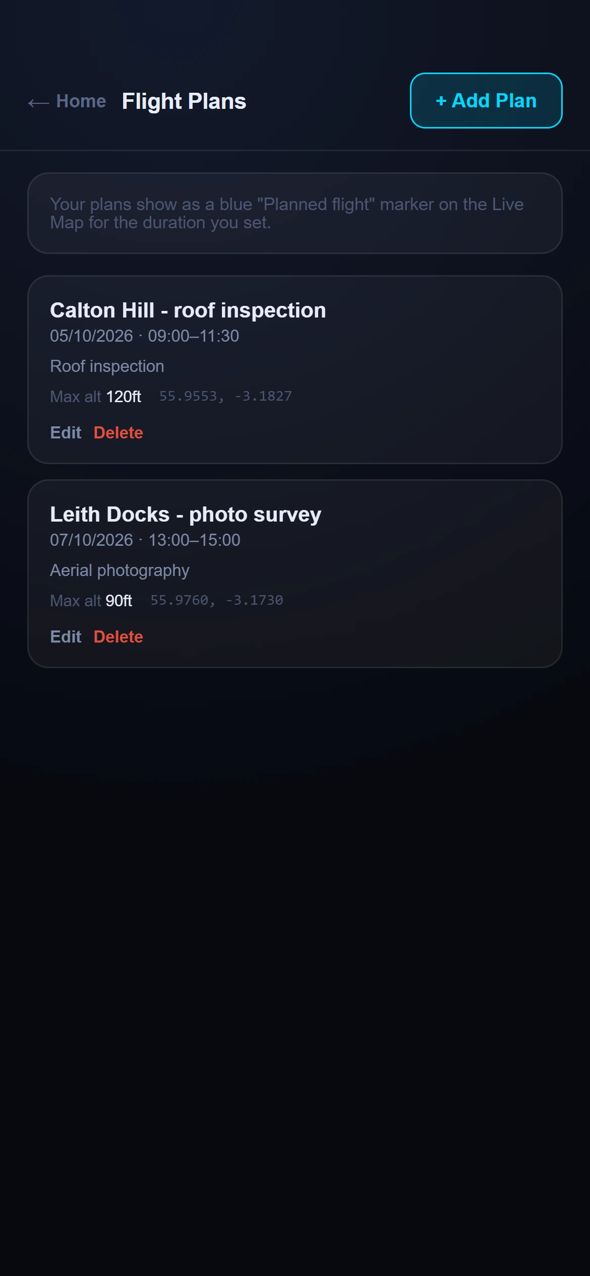
Planned flights show on the live map as upcoming or active, so you can spot who else will be flying near your site. Tap a plan to see its time and height, and send that pilot a message to coordinate.

  • Everyone on the app can see planned flights
  • Pro pilots can publish their own plans and message other pilots from the map
  • Your plan shows only a rough area and the time, never a client or job name
Your kit

Your drones, and your own plans

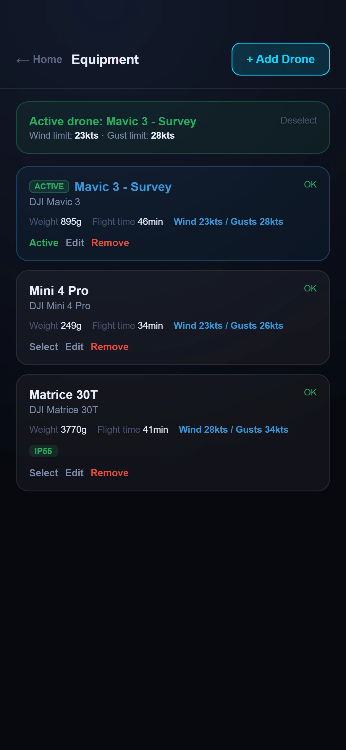
Keep a list of your drones with their wind limits and weights, and plan your own jobs with a place, a time window and notes. The weather and Fly Now results use the drone you choose.

  • Pick from common drones or enter your own limits
  • Search an address or use your current location for a plan
Equipment list of drones
Flight plans list
What gets checked

The things that catch pilots out

Each one is drawn on the map and included in your Fly Now brief.

Airspace

Flight restriction zones, control zones, danger areas, MATZ and airfields, with their hours.

NOTAMs

Active and upcoming notices near you, shown in full and as a zone on the map.

Byelaws

Council notes for parks and open spaces, so you know where take-off may need permission.

Parks and nature

Parks, nature reserves and protected sites near your launch point.

People and places

Schools, hospitals, stadiums, places of worship and railways within range.

Weather

Wind at height, gusts, visibility and cloud for the hour, against your drone's limits.

How it works

From sign-up to launch in three steps

Create a free account

Sign up with your email. No card is needed for the Free plan.

Check the map or run Fly Now

Browse the live airspace, or stand at your launch point and run a scan.

Fly with the facts

Read the brief, check the wind at height, and make the call yourself.

Pricing

Start free. Upgrade when you need more.

The map is free without limits. Pro adds unlimited checks and the pilot tools.

Free

£0 forever

For the occasional flight.

  • Live airspace map, unlimited
  • 10 Fly Now checks a month
  • 10 weather forecasts a month
  • 1 drone in your list
  • See other pilots' flight plans
Start free
Most popular

Pro

£5 / month

For regular and working pilots.

  • Everything in Free
  • Unlimited Fly Now checks and forecasts
  • Unlimited drones
  • Publish your flight plans to the map
  • Message other pilots
Get Pro

Cancel Pro any time from your account page. Prices include VAT where it applies.

FAQ

Questions pilots ask

Where does the data come from?

Airspace, NOTAMs and AIP supplements come from official UK sources and are refreshed automatically. Council byelaw notes, obstacles and nearby sites come from public datasets. Each item says where it came from.

Is it safe to rely on this to decide whether to fly?

AirAware Map is a planning aid, not an authority. You are always responsible for checking the official sources, the rules that apply to you and the conditions on the day before you fly.

Does it work on my phone?

Yes. It is built phone first and works in any modern browser, and a native iOS and Android app is on the way.

What counts as a Fly Now check?

Each time you press Run Scan counts as one check. The Free plan includes 10 a month, and the counter resets at the start of each calendar month. Pro is unlimited.

Who can see my flight plans?

Other signed-in pilots can see a plan you publish on the map: your username, the site name, a rough area of about 1 km, the date and time, and the maximum height. Messages are private between the two people involved.

Can I cancel Pro?

Yes, from the Account page in the app. You keep Pro until the end of the period you have paid for.

Is it only for the UK?

For now, yes. The rules and data are UK specific.

Fly with a clearer picture.

Create a free account and check your next launch site in under a minute.

Start free